Thursday, May 27, 2010

Thursday forecast for May 27, 2010

Picture brought to you by the weather channel


Today: High of 90 and mostly sunny; winds N at 5 mph

Tonight: Low of 68 and partly cloudy; winds N at 5 mph


~Starkville, MS

Currently
Goodmorning and thanks for viewing you Face of the Sky forecast! Another clear and sunny day to start your morning off with current temps in the mid 70s. Winds are calm this morning with dewpoints slowly rising. Dewpoints are already higher than yesterday and of course as dewpoints rises along with temperatures, it makes conditions very muggy and sticky. Also, with higher dewpoints we have another shot of rain today but slim though.

What's Happening Atmospherically
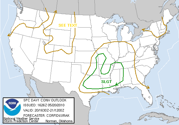
Relatively speaking, today will be just like yesterday's weather. I don't see anything different besides higher but drier dewpoints. The surface temperatures will not be enough to cause convection you generally see during the afternoon. Across the country, we are looking at a high ridge built up in the west with a large trough in the east. The center of the high pressure is in Texas and Oklahoma area. The Kansas and Oklahoma area has been hit hard recently by tornadoes and severe thunderstorms. A good thing for storm chasers wanting to see severe weather in action but lets continue to pray for those people who are being impacted by these storms. Speaking of the nature of weather, only 4 more days until the official day of the hurricane season kicks off. There are meteorologists who say that this year could be very active featuring alot of hurricanes and that the Atlantic is prime to brew up some strong hurricanes. You can check some information concerning this at http://www.2010season.28storms.com/.

Today
Expect conditions to be the same as yesterday but maybe slightly warmer due to increase in dewpoints. A mostly sunny day with temperatures in the upper 80s and lower 90s. Tonight, temperatures will drop to the mid 60s once again with partly cloudy conditions.

Friday outlook
Rain chances comes back into our forecast for tomorrow. Thanks for stopping by to take a look at your Face of the Sky weather for today! Go Magics and may God continue to bless each and everyone of you!

Wednesday, May 26, 2010

Wednesday forecast for May 26, 2010

Picture brought to you by noaa: http://www.hpc.ncep.noaa.gov/noaa/noaa.gif


Today: High of 89 with a possible chance of a stray afternoon shower; NE winds at 5 mph

Tonight: Low of 65 with partly cloudy skies and N wind at 5 mph and becoming calm


~Starkville, MS

Currently
A Happy Hump Day to you all as Wednesday is starting off very sunny and clear for us. As it has been every morning since the beginning of the week, hot and steamy conditions to start your day off with temperatures currently at 72 degrees (9:10 a.m.). What makes it so steamy is due to dewpoints and whenever you have dewpoints over 60, conditions become very muggy. We are still in this summer like pattern by which the temperatures we have having are usually found in mid June and July. Yesterday, we did have showers to cool us off a bit but I think today we'll mostly see sunshine.

What's Happening Atmospherically
Summer like conditions has been the story for this week as a strong ridge has set itself up in the central U.S. In the midst of high pressure, lots of heat and sunshine has enter our forecast. Normally, we are in the lower 80s around this time of year but I do have good news for you as well as bad news. The good news is that temperatures will stay in the upper 80s and lower 90s for a few more days which also makes that bad news as well as we will not see temps fall back to normal. The European model (ECMRF) shows warmer temperatures ahead by next Wednesday, but lets just worry about this week. Both the NAM and GFS do show moisture in the region today with the GFS being the drier one out of the models. The NAM shows some showers in our area but not much to produce heavy rainfall. I think today we'll mostly have a sunny day on tap with possible isolated afternoon showers that may pass through. Models such as the GEFS and the Canadian both show insufficient amount of precipitation. Most of the showers will be kept to the west of us.

Today
Steamy day once more with clouds building up throughout the day but will definitely not limit the amount of sunshine we will get today. Highs will rise to the upper 80s. It will slightly feel cooler due to dewpoints being in the mid 60s today and not in the 70s as it has been previously. We could see an isolated shower here or there but not expecting much rain from it. By tonight, temperatures will cool off to the mid 60s with partly cloudy skies.

Thursday outlook
Tomorrow will not change much as temperatures will continue to stay in the upper 80s. Also, the countdown continues as we only have five more days til Hurricane season kicks off. This has been your Face of the Sky forecast! Thanks for viewing and God bless!

Tuesday, May 25, 2010

Tuesday forecast for May 25, 2010

Picture brought to you by the weather channel


Today: Scattered to isolated showers mainly starting around the afternoon; High of 89

Tonight: Partly cloudy conditions with possible lingering showers; Low of 65


~Starkville, MS

Currently
The Tuesday morning is actually starting off fairly cool for us after having a warm start to yesterday. Temperature is sitting in mid 70s currently with calm winds and scattered clouds.
However, it is still going to be another hot and steamy day as we are still in this early summer pattern.Yesterday, we miss out on a chance to have showers but it looks like today we may receive a bit.

What's Happening Atmospherically
The main challenge in today's forecast is basically determining when rain showers will be here. It could start as early as noon or late this evening. I don't foresee storms being severe or anything because the surface temps and dewpoints should be lower today, so CAPE values shouldn't reach that high but it all depends on how fast it warms up. There are some showers beginning to fire up in the central part of MS right west of I-55. Showers will be due because of the warming of the surface and which basically adds into the instability of the environment. So afternoon showers but should over with by the time the night hours gets here.

Today
I believe the showers should start mainly start around the afternoon hours. Scattered showers throughout the day with highs getting up to the upper 80s. It is not going to be much, but temperatures will be slightly cooler as the surface dewpoints are expected to be lower as well. We'll have an east wind at about 5 to 10 mph which will also continue throughout the night hours. Some isolated showers possible with partly cloudy conditions for tonight. Lows will be in the lower 60s.

Wednesday outlook
Look for temperatures to be on the cool side tomorrow along with plenty of sunshine. I'll be with you all tomorrow for another Face of the Sky forecast. Have a great day and God bless!

Monday, May 24, 2010

Monday forecast for May 24, 2010

Picture brought to you by the weather channel


Today: High of 93 and mostly sunny. Winds NNW at 5 mph.

Tonight: Low of 70 and clear. Winds N at 5 mph


~Starkville, MS

Currently
A rather warm weekend with temperatures reaching in the lower 90s for the first time this year. Yesterday's high even reach the 93 but it felt much more like the upper 90s due to the humidity. As we begin our work week, temperatures are already warming up for us as the current temperatures around the Starkville are in the mid 80s and its only 9:30 a.m. Also, seeing clear and blue skies as well. It already feels brutal outside because dewpoint are steadly rising as well and is at 72 degrees. So, you can expect another warm May day in store for us.

What's Happening Atmospherically
It is only May 24 but it feels like we are in the months of June and July. Like I said previously, temperatures this weekend were in the lower 90s and usually our normal around this time of year is between the lower to mid 80s. The setup we have currently is an upper ridge centered north of the region with high pressure basically driving our weather. With this high ridge in place, we are seeing increasing temperatures and dewpoints. The humidity in the air has made conditions feel more like the upper 90s than what the actual temperatures are. I am expecting temperatures to get back to the 90s, but we have possible showers that may come into our forecast. With the amount of humidity and instability in the environment, some parts will experience some scattered to isolated thunderstorms. The region that will mostly get these isolated thunderstorms west and central part of MS. We could have a chance to receive a sprinkle or two but all the models including the Canadian model depicts most of the showers staying west of us. So, don't be surprised to see some dark clouds in the horizon.

Today
Although, scattered showers west of here I'm not expecting any showers today but if we do it'll only be a stray shower that will only last for a few minutes. Highs will get to the lower 90s once again but will feel much more like the mid to upper 90s due to humidity. We will also see little more clouds enter the sky but still a mostly sunny day. Tonight, a muggy night as humidity continues to stay up. Lows will dip down to the lower 70s.

Tuesday outlook
Although, we will miss the rain today we will have a better shot at getting some showers tomorrow. I don't think it will cool us off much though for those of you hoping for a bit of a cool down tomorrow. Thanks for viewing your Face of the Sky forecast and God bless!

Thursday, May 20, 2010

Thunderstorms Expected Today


Picture brought to you Storm Prediction Center: http://www.spc.noaa.gov/products/outlook/day1otlk.html


Today: High of 86 with scattered afternoon thunderstorms. SEVERE THUNDERSTORM WATCH IN EFFECT UNTIL 7:00 p.m. Heavy rainfall and strong winds are the main threats. Stay tuned to your local weather news for any new updates. Be sure to get easily damaged items indoors such as small pots or flowers due to strong winds.


Tonight: Low of 67; lingering showers throughout the night


~Starkville, MS

Currently
Good afternoon to everyone and I hope all is well with you. Conditions currently are a bit on the muggy side with temperatures in the upper 70s with dewpoint near 70. Yep, something has to brewing up right? Well, we do have some stormy weather heading our way in the next few hours.

What's Happening Atmospherically
A stormy afternoon is in store for in the next few hours as the National Weather Service has issued a Severe Thunderstorm Watch for mostly the northern and central MS counties and Oktibbeha is included in this watch. The Storm Prediction Center has us also in the slight risk area for severe weather. The NWS has issued the watch and it will be in effect until about 7:00 p.m. The reason for this watch is due to a strong potent system pushing its way through. Already, we have storms firing up in portions of AR and the western edge of the MS delta region. According to the latest model run, we have a low which is negatively tilted located in Kansas right now. The low, however, is moving in a northerly motion which will not really allow for us to see any real main threat from this system. When I say main threat I mean possible chance of seeing a tornado. We will see scattered thunderstorms in the area with winds gusting up 70mph. Winds can certainly caused alot of damage when speeds are that high. Also, the possibility of a tornado in some areas cannot be ruled out either. Certainly, today we will see heavy rainfall here but our southern counties will miss out on the brunt of this system. Mostly, they will see isolated thunderstorms. The pieces are mostly together for severe weather as by looking at 300 mb, I am seeing some divergence and rising air being in the favorable part of the jet streak. So, some good strong upper level winds. Small bits of PVA (positive vorticity advection) in the area, but not much. Also, some very good warm air advection in place looking at 850mb. So, the elements and I certainly can't rule out possible tornado. The main thing to worry about is the heavy rain and winds. I'll keep you all updated if any severe threat becomes apparent. Today, the warm sector or warm front will give us this rain, as the cold front which will drag behind gives us another round of showers Friday.

Today
Expect for scattered thunderstorms throughout the afternoon hours with heavy winds associated with a low pressure system. Lingering showers throughout the night hours.

Friday outlook
Rain still in our forecast tomorrow as that cold front finally drags down. After it moves out, it looks like conditions clears back out for us this weekend. Be sure to always give God the glory whether its sunny or stormy outside! God bless!

Wednesday, May 19, 2010

Wednesday forecast for May 19, 2010

Really Short blog forecast:

High of 82 today and mostly sunny

Low of 60 tonight and partly cloudy

Showers expected for tomorrow.

God bless!

Tuesday, May 18, 2010

Tuesday forecast for May 18, 2010

Picture brought to you by the weather channel


(P.S. I have a special song today by which I have been singing these couple of day. I hope you enjoy as well! By the way, GO MAGICS!!!!)


Today: High of 82 and mostly sunny; winds northwest at 10 mph

Tonight: Low of 56 and clear


~Starkville, MS


Currently
Goodmorning and welcome to your Tuesday edition of your Face of the Sky forecast. Temperatures have been right around their normal around this time of year throughout the weekend and for yesterday. I am personally glad about that. We definitely do not need it to be hot so very soon especially with summer not even being here yet. The average temperature for May is usually around 82 and so we have been hovering around that number these past couple of days. This morning felt really nice outside if you were jogging or even heading off to work. Temperatures currently are in the upper 60s with scattered clouds. Comfortable winds are from the NE at around 10 mph. Good news is these type of weather conditions should last for at least two more days.

What's Happening Atmospherically
After having a low pressure swing through the south this past weekend, high pressure behind it has started to build back in into the region. At 850 mb, both the NAM and GFS shows some cool air in the Mississippi throughout both today and Wednesday. 850 mb is showing cool air north of the southern region. The high pressure which is northwest of us is pushing this cool air into our region, which is allowing for us to return back to our normal temperature range. Even though it will be mostly sunny today, due to some low and mid-level moisture we might see an increase in cloud coverage this afternoon. This frontal boundary will mostly be kept south of here along I-20 and in our southern counties due to this high pressure off in the northwest. So, south MS will see some showers today but I don't believe these showers will reach here.

Today
Another May day with warm temperatures in the lower 80s. Mostly sunny but more clouds are expected today with this frontal boundary south of us. A mostly clear night tonight with temperatures on the cool side. Temperatures will be in the mid 50s with winds northwest at 5mph and then becoming calm overnight.

Wednesday outlook
Average temperatures for tomorrow with more sunny conditions in store for us. We do have more rain on the way with strong to severe weather possible late Wednesday night into Thursday. I'll have more details on that tomorrow. Have a great day and God bless!

Friday, May 14, 2010

Weekend Outlook

Picture brought to you by the weather channel

Today: High of 87 with partly cloudy skies; isolated afternoon possible

Tonight: Low of 67; isolated showers possible


~Starkville, MS

Currently
A good Friday to you all and thanks for checking out your Face of the Sky forecast. A rather warm on yesterday with temperatures in the upper 80s. It didn't quite get to 90 yesterday as conditions outside looked sort of hazy. Also, more clouds in the sky inhibited the amount of sunlight that I thought would be out on yesterday. Temperatures right now is at 82 degrees with high scattered cirrus clouds in the sky. We still kind of have this hazy look going on which occurs due to dust or smoke in conjunction with dry air. Basically, it just affects your visiblity
and how far you can see far off. Dewpoint is in the mid 60s with calm winds.

What's Happening Atmospherically
High pressure will continue to move off farther east as a weak frontal boundary begins to push toward the Southeast. The high pressure will actually help stall this frontal boundary; therefore it will not allow for the rain that is associated with it to just push on through. So throughout the weekend as this frontal boundary is over us, we will just have scattered showers throughtout the Mississippi region. So, even if we are mainly sunny here in Starkville there is going to be a place in MS that is going to see some showers. Stronger showers will be mostly north as you have better development in convection in north MS. Models are pretty much all over the place concerning rain chances and which places will be receiving precipitation at certain times. However, both the GFS and the NAM both show a greater chance for widespread rain for Saturday evening through Sunday night. The reason for this is mainly due to high pressure again completely moving toward the east allowing for that frontal boundary to push on through. As far as temperatures, the GFS and ECMWF shows temperatures dropping back around average for this time of month with the ECMWF showing possible cooler than normal temps by mid week of next week. Should be an interesting development!

Today
Highs will get up to the upper 80s once again, and I don't believe we will make it to 90 as I last forecasted. Partly cloudy throughout the day with winds from the south at 5mph. Keep your umbrella in hand for possible isolated afternoon showers. Upper 60s will once again be on tap for tonight's lows. Again, if your going out just be sure to have your trusty umbrella with you.

Weekend outlook
Scattered showers lingering through the day for Saturday. Widespread rain will come late Saturday night and into Sunday evening. We will see our best chances of rain during between those two time periods with temperatures mainly stay in the mid 80s as temperatures try to get back into its average around time of year which is normally around 82. We could be looking at cooler than normal temperatures next week, so stay tuned for that. Hope you all have a great weekend and God bless!

Thursday, May 13, 2010

Thursday May 13, 2010 Face of the Sky forecast


Picture brought to you by the weather channel

Today: Mostly sunny day with clouds and a high of 89

Tonight: Warm and muggy night with a low of 68


~Starkville, MS

Currently
A good day to you all and thanks for viewing your Face of the Sky forecast for your Thursday. One more day until the weekend! We are starting off very warm and muggy this morning with temperatures already in the lower 80s. Dewpoint is at 70 which makes the air around us feel sticky and muggy. This is only the beginning to a rather warm and humid day ahead of us.


What's Happening Atmospherically
We still have a high ridge of high pressure in the Gulf right now bringing in warm, moist air into the region as it rotates in a clockwise manner. However, we do have a low pressure system off to the west of us and as the high pressure weakens and moves further east, this low pressure will soon begin to have an impact upon weather consisting of showers back into forecast later this weekend.


Today
We are already in the lower 80's and temperatures will steadly rise throughout the day. Some parts of the MS region will hit the 90 degree mark for the first time this month. Here in Starkville, 90 degrees will be knocking on our doors as well. It will basically depend on how much cloud cover will inhibit the amount of sunshine. So, a very sunny day with thick cumulus clouds to fill the sky. Winds from the south at 10mph will help somewhat to cool us off at times. Also, some isolated showers will occur in some parts of MS mainly north but I don't expect any showers here today. It will continue to be humid as the evening and night hours approaches. Lows will be in the upper 60s with muggy conditions and some cumulus clouds out. Winds will die down just a little at about 5mph from the south.


Friday outlook
If we don't get to 90 degrees today, then certainly tomorrow we will hit it as another warm day in store for tomorrow. Maybe some isolated afternoon showers in the area but nothing really to worry about for tomorrow. Thanks and God bless!

Wednesday, May 5, 2010

Graduation!!!!!!


Hi Everyone! I'm really sorry for not posting and updating you all Face of the Sky forecast. I have been so busy lately especially with it being the end of the semester and GRADUATION!!!! Yep, I graduated Saturday May 1, 2010!! It was incredible and a great day. It is one of those days that I will never forget. My four years here at Mississippi State University has been wonderful and God definitely sent me here for a reason. I grew alot spiritually and in my education level. Alot of things have been experience here at state and I thank God for the growth. One day I will have to write a book concerning God's favor on me during my college years and throughout everything but that is for a different in my life. Right now, I am just focusing on moment and on the task at hand. Most of you are probably wondering is next for me.

Well, first of all I do have one more class to partake in in the month of July which Physics 2. Yea, I know ugh!! After that, I will be officially done with my undergrad year. So, since I'm still techinally in school I am still able to continue to intern at WTOK. I have been interning there in late January. So, plan to keep interning there up til about sometime in June. By then I should have forecasting shows from there that I can add to my resume. By adding these shows to my resume, it really shows that I have a little bit of experience outside of the classroom experiences. I believe this help greatly in finding a job. About my resume, I planned ship my shows to a company in Birmangham, AL to have my resume tape done by a professional staff. Once I have my resume tapes in, I can officially start the job search or hunt.

Also, while I'm in Starkville I will be working as well since I still have my apartment to pay for. My last finals plans is of course continue to update you on the weather. I'm sorry again for not forecasting on a daily basis. I definitely would like to do that just to keep my forecasting skills sharp. Thanks to all my loyal supporters! You all have helped more than you know. Thanks for viewing my page each time I update. It's been such a pleasure being able to do this for the Starkville community. Even if you've only check out my site only once, I still truly thank you because you didn't even have to do that. I will continue to update you all on the summer plans and about my life. Keep praying for me and hoping for the best! I know God has a plan for me!

Be sure to watch out for a update in the next day or so! Thanks again and may God continue to bless each and everyone of you!

music


Get a playlist! Standalone player Get Ringtones