Thursday, February 24, 2011

Lightning

Today is the fourth day of our Severe Weather Awareness Week for the Mid-South. We are going to focus on the topic of lightning today. Most of the information provided is by the National Weather Service and for more information you can visit http://www.srh.noaa.gov/jan/.


Lightning Nationwide in 2010, 30 people were killed by lightning. Since 1959 a staggering 3919 people have lost their lives as a direct result of being struck. In an average year around 25 million lightning strikes are recorded across the United State alone. Worldwide there are around 1800 thunderstorms ongoing at any given time. Lightning is an incredibly powerful electrical discharge, containing up to 100 million volts of electrical charge and capable of reaching 50000 degrees Fahrenheit. Cloud to Ground Lightning is the result of incredible differences in electrical charge which forms within thunderstorm as well as between thunderstorms and the earth’s surface. Recent science suggests that ice in thunderstorms is key to creating the massive charge differences which lead to lightning.

Thunderstorm updrafts and downdrafts work to separate smaller ice particles from larger hail stones within the storm. As this happens many of the ice pieces collide resulting in a separation of electrical charge. The higher part of the storm contains primarily positively charged small ice crystals, with negative charged larger chunks of ice down low. As the storm moves across the earth a pool of positively charged particles gathers near the ground. Eventually a brief electrical circuit is created as a negatively charged “step leader” descends from the storm toward the ground and eventually connects to the positive charge on the ground. The extreme heating of the air with lightning causes a rapid expansion of the air around it, leading to thunder. The sound of thunder will travel away from lightning at a speed around 1 mile every 5 seconds. If you can see lightning and hear thunder at your location you are not safe, if you hear thunder within 30 seconds after seeing lightning your life is in immediate danger.

Lightning Safety Rules—Outdoors
- Seek shelter inside a house, large building or an all metal vehicle with the windows rolled up (avoid convertibles).
-If your hair stands on end and your skin tingles... lightning is about to strike. Take cover immediately!
-When boating, head for shore and get into a shelter, or vehicle. If caught in a boat, lie down in the boat with cushions between you and the boat's side and bottom.

AVOID
- Large trees, hilltops and other high places.
-Chain link fences and any other metal fences like those around ball parks and play grounds.
-Motorcycles, scooters, golf carts, small metal sheds, bicycles, tractors and farm equipment that does not have an enclosed metal cab.

Lightning Safety Rules - Indoors
-Stay away from windows. Avoid telephones and electrical appliances (wires connecting to these devices run outside of the home and act as lightning rods). Don’t wash dishes or take a shower. The pipes will conduct electricity.
-Unplug computers and other sensitive electrical devices (time permitting) since surge suppressors may not protect these items if lightning hits close to the home.
-Remember, there is no truth to the old myth that ―lightning never strikes twice.‖
- Take time this week to learn or refresh your memory on lightning safety rules. That quick dash out in the open when a thunderstorm is in progress may unnecessarily expose you to the possibility of being struck. It is not worth the risk.
- If a person is struck by lightning, there is no residual charge left on the body. The quick application of CPR may maintain vital body functions until medical help can be obtained.

Wednesday, February 23, 2011

Tornadoes

***Be sure to check out today's weather forecast. If you scroll down the page, it should be the previous blog.***


Today is the third day of our Severe Weather Awareness Week for the Mid-South. We are going to focus on the topic of tornadoes. Most of the information provided is by the National Weather Service and for more information you can visit http://www.srh.noaa.gov/jan/. Also, I took information from another blog called MemphisWeather.Net Blog. The blogger had great information on safety and I wanted to include that. For more information, search http://blog.memphisweather.net/

Tornado
A tornado is a violently rotating column of air that extends from the base of a storm cloud to the ground. Some conditions that are conducive for tornado formation include warm, moist, unstable air, strong atmospheric winds that increase in speed and change direction with height, and a forcing mechanism to lift the air. When a combination of these factors comes together just right, tornadoes form. The most common time of year for tornado formation in Mississippi is during the spring months of March, April, and May, with a secondary tornado season in November. Additionally, the afternoon and evening hours are the times of day at which most tornadoes occur, as they are the times at which the maximum heating takes place. However, tornadoes can occur at any time of day, and at any point during the year, given the right environment. Many tornadoes occur at night in Mississippi.

Nighttime Tornadoes Pose Greater Danger
The NWS would like to draw attention to nighttime tornadoes. These tornadoes pose a greater danger than those that occur during the daylight because once most people go to bed, they are no longer connected to the watches or warnings issued by the NWS. Also at night, visibility is reduced and observing a tornado is more difficult. This is elevated during the winter months because it is not the traditional tornado season. Research by Gagan et al. 2010 compared tornado statistics from the Great Plains in the classic “Tornado Alley” to tornadoes in the Deep South or “Dixie Alley.” Researchers found that Dixie Alley had far greater amounts of Killer Strong/Violent Tornadoes between 9pm-9am timeframe. Dixie Alley had nearly twice the number of strong/violent tornadoes from Midnight-Noon timeframe than Tornado Alley from 1950-2007.
Having an properly programmed All Hazards NOAA Weather Radio with S.A.M.E. County Coding technology will alarm individuals anytime of day when a severe thunderstorm warning or tornado warning is issued for their county. This device has been credited for saving numerous lives during nocturnal tornado events.

Enhanced Fujita Scale (EF Scale)
EF Rating Wind Speeds Potential Damage Threats
EF 0 (weak) 65-85 mph Light damage, shallow rooted trees pushed over, some damage to gutters or siding.
EF 1 (weak) 86-110 mph Moderate damage, mobile homes overturned, roof surfaces peeled off.
EF 2 (strong) 111-135 mph Considerable damage, large trees uprooted or snapped, mobile homes destroyed.
EF 3 (strong) 136-165 mph Severe damage, trains overturned, well built homes lose roofs and walls.
EF 4 (violent) 166-200 mph Devastating damage, well built homes leveled, cars thrown.
EF 5 (extreme) Over 200 mph Incredible damage, well built homes disintegrated, automobile-sized objects thrown
>300ft.

Your safety depends on being constantly alert to the possibility of tornadoes from the thunderstorms that approach you. Plan in advance where you will go and what you will do if a tornado threatens you.

Warnings and Watches
A tornado watch means that a tornado development is possible. Stay tuned to a weather radio or television station for weather statements or warnings.

A tornado warning usually issued for one or two counties a a time means that a tornado has sighted or indicated by weather radar. If you are in the path or you know somethere in that path, you need to seek shelter immediately preferably in a sturdy building and below ground if all possible.

Safety Rules

-In homes or small building go to the basement, storm shelter, or to an interior room such as a closet or bathroom. While there be sure to get under something sturdy such as a heavy table or bed. If you are in a bathroom, be sure to take a bed mattress over you while your in the tub to protect yourself.

-In mobile homes and vehicles, please abandon them and go to a storm shelter or sturdy structure. If there is now structure nearby, lie flat in a ditch ravin, gully, culvert, or low spot with your arms and hands shielding your head. Please do not stay in your mobile home. You will be much safer lying in a ditch rather than in your mobile home. Many deaths have occurred due to residing in mobile homes during tornadoes. Mobile home can easily be picked up by a tornado.

-In large buildings such as schools, factories, hospitals, nursing homes, and shopping centers go to the predesignated shelter shelter area. Interior hallways on the lowest floor are usually best. Stay away from rooms that are large in area because they have weakly supported roofs.


AT ALL TIMES... STAY AWAY FROM WINDOWS.

Below are four videos of some great tornado coverage. Be sure to pause the music in the background in order to hear the audio clearly(Scroll to the bottom of the page to stop the music). The first two videos are by a very good friend of mine and was my teacher/instructor for senior meteorology classes. Greg Nordstrom is an avid storm chaser and I've learn much from him. He has alot of information on his page as well as great chase videos not only consisting of tornadoes but hurricanes. You can visit his youtube videos at http://www.youtube.com/ldctstormchaser Some language may be involved, but Greg has some of the best videos of tornadoes I've ever seen and I'm sure you all will concur after watching.

The other two videos are coverages by James Spann in AL and a good friend and advisor of mine in Dave Freeman.


It's That Time of Season

Today's forecast:
Jackson, MS-------High 78 Low 57

Starkville, MS-----High 67 Low 54

Meridian, MS------High 74 Low 52

Vicksburg, MS-----High 76 Low 58

Greenwood, MS----High 70 Low 61

Tupelo, MS--------High 63 Low 54

Hattiesburg, MS---High 79 Low 54

Pascagoula, MS----High 74 Low 61


~Jackson, MS

Currently~as of 9:35a.m.
I hope you all are having a good Wednesday. So far, this week has gone by just like any of the previous week with sunny conditions and mild temperatures. We've actually been going through mid-February on a quiet with hardly any substantial rain to speak of. I admit it has certainly been nice and I've been enjoying these Spring-like conditions to the fullest. However, on Thursday our flow will be interrupted by severe weather. Like I stated yesterday, it's very ironic that on the week of Severe Weather Awareness Week we have severe weather on the same week. We are in that time of season though.

What's Happening Atmospherically
Observing surface maps, a warm front will push from the south today and help to raise temperature across the state. We would probably just ended up in the upper 60s and lower 70s again today, but this warm front is going to increase temperatures despite being much more cloudy today. Great warm air advection taking place with this warm front moving north and I don't think we'll see much rain from this warm front today. From this front in the Jackson area, we'll only more clouds and temperatures above normal. Also, because of this warm front and clouds coverage lows tonight will be quite mild and only falling into the upper 50s in Jackson, This will really help transition weather for Thursday.


For Thursday, we do have severe weather starting in the afternoon hours. The area of concern is around the northern MS, AR, and TN regions. There is potential for strong tornadoes to break out there. Here in Jackson, we could see some strong severe strong swing by although Bufkit files does not display alot of precipitation with it. Strong winds will occur as well. I will have more updates for you later today as well as more information.

Tuesday, February 22, 2011

Flooding and Flash Floods

***Be sure to check out today's weather forecast. If you scroll down the page, it should be the previous blog.***


Today is the second day of our Severe Weather Awareness Week for the Mid-South. We are going to focus on the topic of flash floods. Most of the information provided is by the National Weather Service and for more information you can visit http://www.srh.noaa.gov/jan/.

Flash Flooding
Flash floods can occur within a few minutes or up to 6 hours after excessive rainfall, a dam or levee failure, or a sudden release of water held by an ice jam or mud slide. Flash floods can wash out roads, destroy buildings and bridges. Due to flash floods occurring in a short period of time (less than six hours after the causative event) they are more life threatening than other types of flooding. Areas most susceptible to flash flooding are mountainous streams and rivers, urban areas, low-lying areas, storm drains, and culverts.

Warning
A Flash Flood Warning is issued when flash flooding has been reported or is imminent. It focuses on specific communities, creeks or streams, or other geographic areas where flooding is imminent or occurring.

River Flooding
This type of flooding is caused by an increased water level in established watercourses, such as a rivers, creeks, or streams. River flooding is slower to develop than flash flooding (more than 6 hours after the causative event), however, some smaller creeks and streams have a short lag time between the runoff from heavy rain and the onset of flooding. On the other hand, it may take several days for a flood crest to pass downstream points on major rivers such as the Lower Pearl, and Mississippi Rivers. The NWS issues River Flood Warnings when rivers are expected to rise above flood stage. Persons in the warned area are advised to take necessary precautions immediately. River stages and crest forecasts are given for selected forecast points along with known flood stages for each forecast point. While there is usually more advanced warning time with river floods than with flash floods, persons should be familiar with the flood prone areas they live and work in, and must know what action to take and where to go if a flood occurs. Advance planning and preparation is essential.

Flood Watch
The NWS issues a Flood Watch when conditions are anticipated that could result in either flooding or flash flooding within a designated area. Persons in the watch area are advised to check flood action plans, keep informed, and be ready to take action if a warning is issued or flooding is observed.

Flood Safety Rules
Follow these tips to stay safe during flood condition:
1. When a warning is issued get out of areas subject to flooding. If caught in low areas during flooding, go to high ground immediately.

2. Avoid already flooded and high velocity flow areas. A rapidly flowing stream or ditch can sweep you off your feet or even carry your car or truck downstream.

3. Never drive through a flooded area as the road bed may be washed away. Play it safe! If you encounter a flooded road... TURN AROUND, DON’T DROWN!

4. Be especially cautious at night when it is harder to recognize flood conditions, and never drive around a barricaded road. Most flood deaths occur at night and when people become trapped in automobiles that stall in areas that are flooded. If your vehicle stalls, abandon it immediately and seek higher ground. The rising water may engulf the vehicle and the occupants inside.

5. Do not camp or park your vehicle along streams or washes during threatening conditions.
When a FLOOD WARNING is issued for your area, act quickly to save yourself. You may only have seconds!


Here are a few videos: The first video is by NBC covering a flash flood story. The second video is by a guy who's screen name is TornadoChaser and he recorded a current flash flood. The last video is by a CNN ireporter covering a river/flash flood in Nashville, TN.

***Please be sure to pause the background music in order for you to really hear the audio from the video below. To do just that, scroll down to the very bottom of the page and you will be able to pause or stop the background music.***


Slight Risk of Severe Storms for Thursday

***Don't have time to read my blog?? Well, please check out my weather radio podcast! It's very easy and quick to the point. To listen to my radio podcast, go to the right of the page where it says Weather Radio Podcast. Click on play and there you have it. Also, you may have to pause the music that's playing in the background in order for you to hear the weather podcast. In order to do just that, go to the very bottom of the page and click pause. Enjoy!***


Today's forecast:
Jackson, MS-------High 67 Low 47

Starkville, MS-----High 62 Low 38

Meridian, MS------High 67 Low 43

Vicksburg, MS-----High 63 Low 49

Greenwood, MS----High 59 Low 43

Tupelo, MS--------High 59 Low 34

Hattiesburg, MS---High 72 Low 49

Pascagoula, MS----High 72 Low 49


~Jackson, MS

Currently~as of 7:05a.m.
Hi and I hope everyone is doing wonderful on this nice Tuesday. Currently, temperatures are in the mid 50s right now. We had cloudy skies throughout the night in the Jackson Metro area and that helped to keep temperatures out of the 40s. We didn't see any type of rain yesterday from the cold front that swung through. Even though it did not bring any type of moisture into the region, it was the reason for the cloudy conditions last night and will be the primary reason for cooler temperatures today. Also, we may have our next chance for rain this coming Wednesday evening and Thursday and it could come along by way of severe weather.

What's Happening Atmospherically
A cold front is going to stall across the MS region partially for today and this cold front will bring slightly cooler highs back into our forecast. The map to the left shows a cold front at the hour of 7:45 this morning. Temperatures behind the front are in the lower 50s, while temps in front of it are in the 60s. This sets us up into seeing varing temperatures throughout MS as cooler temperatures to our north and warmer temperatures in the south. We will have between a 5-10 degree drop in our high temperatures today as this front continues to push southward. Highs will only stay in the 60s. Clouds should hang around until the afternoon and by then we'll see more and more of the sun as the afternoon progresses. The front should be completely out by tonight.

For tonight, a ridge of high pressure will begin to build back in into our region moving in from the east. Now, as we get into Wednesday a warm front will push through from the southwest and will bring Gulf moisture along with 70 degree temperatures back to the South. The chart to the right shows warm front coming out of the southwest and located in the central part of MS by Wednesday evening. From this warm front, there will be a chance for light precipitation on Wednesday night although it will not be anything significant. Don't be surprise of a few sprinkles.

It's ironic that we could have potential severe weather on Thursday here in Jackson because this week being our Severe Weather Awareness week. You may even get to use some of the practical tips. There is still some discrepancy between models as to the timing of severe storms and makeup of key ingredients. Even though there are some disagreements amongst models, everything still points to a slight risk of severe weather for Thursday. According to the SPC (Storm Prediction Center) Day 3 Outlook, most of the severe storms will occur in eastern Oklahoma, eastern Arkansas, and southern Missouri, northern Mississippi and Alabama, and into the Tennessee and Ohio valley. Its due to a potent shortwave trough traveling from the plains by early evening on the surface. The shear profiles already favors supercells and bowing structures and anytime you have strong shear profiles like these, it is usually condusive for tornadoes. Later today and especially tomorrow, models should have a better grasp on the ingredients and timing of this. As far as the Jackson area though, we will definitely have rain and possibly a few severe storms that may through. I'll keep you inform as much as I can in the next 48 hours.

Today
A 10 degree difference in temperatures as highs today will remain in the 60s compared to highs yesterday around Jackson coming one degree short of 80 degrees. Cloudy for the start of today and by the early afternoon we should see more glimpses of the sun and settle into a mostly sunny day. Winds will come out of the northwest at 5-10mph.

Tonight
Cloud coverage kept us from falling into the 40s last night but it looks like tonight we will drop into the upper 40s. We'll have partly cloudy skies on hand with winds at first from the northeast at 5mph but then becoming east southeast.

Long-term
Severe weather for Thursday with more severe weather next week. Yep, we are getting into that time of season again. Stay tuned and God bless!

Monday, February 21, 2011

Severe Storms

***Be sure to check out today's weather forecast. If you scroll down the page, it should be the previous blog.***


Today is the start of our Severe Weather Awareness Day for the Mid-South. We are going to start with the topic of severe storms.

What is a Severe Thunderstorm?
A severe thunderstorm is a thunderstorm that produces one or more of the following:

1. hail that has a diameter of one inch (quarter size) or larger
2. winds greater than or equal to 58 mph
3. tornadoes.

If a storm does not contain any of the following characteristics, it is not severe. It does not matter how bad lightning strike or heavy rainfall, if it does not contain either these qualifications then it is not severe. There are about two thousand thunderstorms going on around the world at a given time but only a small percentage is actually severe. About 10% of all thunderstorms in the U.S. meet severe criteria. Severe thunderstorms can occur at any time of year, although the most common time of occurrence is during the spring months of March, April, and May. In addition, pulse-type thunderstorms during the summer months can produce high winds, frequent lightning, and torrential downpours. There is also a secondary season of organized severe weather in Mississippi, in November and early December.

There are a few types of severe thunderstorms such as pulse storms, multicell storms, MCS, and even supercells. Severe thunderstorms co-exist due to three synoptic airstream's
1- low-level southerly flow from 925mb up to 850mb
2- mid-level southwest flow from 925mb to 700mb
3-jet stream flow at 300mb

The four primary ingredients for severe thunderstorms are: instability, shear, lifting, moisture. The severity of a storm is dependent upon two things: instablity and shear. Instablity determines strength of storms and shear determines storm types. The life of a thunderstorm depends upon the strength of the updraft.


What is the Difference between a Watch and a Warning?
A severe thunderstorm watch means that conditions are favor-able for severe thunderstorms to develop. These are issued by the Storm Prediction Center in Norman, OK, typically before
severe weather is developing.

A severe thunderstorm warning means that a severe thunder-storm has either been indicated on radar or witnessed by storm spotters. Your local NWS Forecast Office issues severe thunder-storm warnings when severe weather is developing or occurring.

How Is Hail Formed?
Hail is formed when water droplets are drawn into an area of strong upward moving air, known as an up-draft, of a storm. Once the water droplets are trans-ported above the freezing level, they combine with tiny airborne particles, such as dirt, salt, volcanic ash, etc., and freeze on contact, forming tiny ice par-ticles. Once the hail stones are heavy enough to overcome the upward force of the updraft, they fall out of the cloud. If large enough, hail can inflict significant damage to automobiles, buildings, crops, and even people.

NWS Hail Criteria
As of January 5, 2010, the National Weather Service has changed the severe hail criteria from 3/4 inch to 1 inch. Why the change? There are a couple of reasons. Research has shown that significant damage caused by hail does not occur until the hail diameter reaches one inch (approximately quarter size) or larger. Requests from NWS partners such as emergency managers and the media further prompted the decision to increase the severe hail criteria due to the fact that more frequent severe thunderstorm warnings may act to desensitize the public from their meaningfulness. Such an effect could cause people not to take caution during such a warning, which could lead to unnecessary damage or injury. The change means that severe thunderstorm warnings for hail will be issued less frequently so that a greater emphasis can be placed on more substantial hail threats.

Hail Size Estimates
Pea……………………..…………………………………1/4 inch
Penny…………………………………………..……...….3/4 inch
Quarter…………………………………………………..….1 inch
Half Dollar………………………………….………..1 1/4 inches
Golf Ball……………………………………………...1 3/4 inches
Tennis Ball…………………………………..………2 1/2 inches
Baseball……………………...………...…..………..2 3/4 inches
Grapefruit……………………………….………………..4 inches

Safety Tips
-Have a plan. Prepare ahead of time so you and your family know what actions to take when severe weather occurs.
-Get indoors! There is no safe place outdoors during a thunderstorm.
-Stay informed! When severe weather threatens, stay tuned to NOAA Weather Radio, local television and radio stations, or the NWS homepage online at www.srh.noaa.gov/ for up to date information on the weather situation. Click on the office that serves your area.
-Know what county you are in. When a warning is issued, the threatened area will be identified by the counties that contain it.
-Have a NOAA Weather Radio. This is the best way to receive the latest and most up to date weather information from the National Weather Service.


***Please be sure to pause the background music in order for you to really hear the audio from the video below. To do just that, scroll down to the very bottom of the page and you will be able to pause or stop the background music.***

Warm Pattern Continues but Rain Trying To Creep Back

***Don't have time to read my blog?? Well, please check out my weather radio podcast! It's very easy and quick to the point. To listen to my radio podcast, go to the right of the page where it says Weather Radio Podcast. Click on play and there you have it. Also, you may have to pause the music that's playing in the background in order for you to hear the weather podcast. In order to do just that, go to the very bottom of the page and click pause. Enjoy!***


Today's forecast:
Jackson, MS-------High 76 Low 54

Starkville, MS-----High 74 Low 47

Meridian, MS------High 76 Low 52

Vicksburg, MS-----High 76 Low 49

Greenwood, MS----High 76 Low 43

Tupelo, MS--------High 72 Low 43

Hattiesburg, MS---High 76 Low 56

Pascagoula, MS----High 72 Low 56


~Jackson, MS

Currently~as of 8:30a.m.
A good Monday to you all and Happy Presidents Day! I hope everyone had a fantastic and lovely weekend. Surely, I'm hoping that you had a chance to get out of the house and enjoy the beautiful Spring-like weather. It certainly does not feel like we are still in the month of February. Temperatures this weekend had highs in the mid 70s throughout with Saturday being the warmest day with 78 degrees around the Jackson area. It was two degrees away from 80! Even as we continue for the first part of this week, this weather pattern will still persist. Currently, temperatures are in the lower 60s and warming up very nicely. Thick clouds this morning but most of it should erode away by early afternoon. Even though we are remaining dry and sunny for the start of the week, we may see rain start to creep back into our forecast later today and sometime throughout the week.

What's Happening Atmospherically
We are still in the midst of a warm and dry weather pattern. Basically this involves good warm air advection at 850mb coming southwest out of the Gulf of Mexico. The chart to your right shows good warm air advection from the south still strong today at around this evening. We also have a surface high pressure which have also aided in allowing for sunny conditions throughout Mississippi. Observing current water vapor images, it is very dry and warm in the Gulf. So since this surface high pressure circulates in a clockwise fashion, it helps to bring in this dry and warm conditions to the South. However, we could see some moisture later this evening.

Later this afternoon we are going to have a cold front swing through the Arkansas and Mississippi region. Due to this and the pressure gradient, we will have windy conditions today but nothing to warn about concerning hazardous wind conditions. So as this cold front extends further south, it will bring moisture back into the region. According to the Climate Prediction Center, we do have a little bit of drought going on so precipitation is needed in the area especially south MS. However, due to the lack of moisture mostly held up north and the lack of forcing we won't see much of precipitation. At best, we will have light showers and sprinkles. The map to your left is the QPF chart(Quantitative Precipitation Forecast). It is showing that between the hours of 6pm this evening to Tuesday morning at 1:00am, a little under 0.01" of rain will have fallen between those time. So, no need to expect much from rainfall total as the likeliest area to see rain is in north MS mostly along the Hwy 82 corridor. This cold front will do three things for us: 1st-Bring windy condition through today 2nd-Overcast conditions tonight 3rd-Slightly drop day-time temperatures tomorrow. This front will look to stall a bit over the South throughout overnight which will be reason for overcast skies.

Instead of being in the mid 70s tomorrow, temperatures will drop closer to our average and end of being in the mid 60s and possibly still in the lower 70s. By Wednesday, a ridge of another surface high pressure will have settled across the region as well as warm air advection will go back to coming out of the south to give us highs back into the 70s once more.

Today
A little bit windier today as an approaching front moves through Mississippi this evening. Winds will be between 10-15 mph mainly out of the south and will gust at times to 30mph. We may get a few sprinkles here and there, but nothing major. Highs around the Jackson will be in the mid 70s with scattered cumulus clouds. It will make for yet another beautiful day.

Tonight
Skies should be covered tonight, but yet it will still be relatively warm with lows dropping into the lower 50s. The wind will have calm down just a tad bit with winds out of the north between 5-10mph.

Tuesday's outlook
Slightly cooler tomorrow as this front completely moves out of the area. We should still be warm with highs in the mid to upper 60s. A sunny day as well with winds from the northwest at 5 to 10 mph.

Long-term
This coming Thursday should provide our next best chance for rain as another cold front swings through. We could possibly see some severe weather with this as conditions will be humid in front of this storm. Forecasts models will be a little clearer on this tomorrow. Other than that, it does not look like we will be escaping this warm weather pattern anytime soon. Enjoy your Monday and God bless!

Friday, February 18, 2011

Quick Forecast Update

***Don't forget that next week for Mississippi is our Severe Weather Awareness Week. Face of the Sky will be participating in SWAW. Basically, various severe weather topics will be discussed all next week along with current weather conditions. This is a great opportunity to learn and prepare for any severe weather outbreak that is due to come this spring and in the future and I will help to assist you in educating and learning all about threats that comes along with severe weather. So, starting next week I will blog concerning forms of severe weather such as tornadoes and lightning and what to do in such situations. Here is a rundown of what I will blog about each day next week and I am following the rundown by the National Weather Service:

Monday- severe storms
Tuesday- flash floods
Wednesday- tornadoes
Thursday-lightning
Friday-watches and warning

I will also try to post lots of pictures and videos. Please be sure to join me all next week for an exciting and electrifying week.***


Today's forecast:
Jackson, MS-------High 78 Low 56

Starkville, MS-----High 71 Low 53

Meridian, MS------High 75 Low 50

Vicksburg, MS-----High 75 Low 51

Greenwood, MS----High 74 Low 55

Tupelo, MS--------High 68 Low 52

Hattiesburg, MS---High 76 Low 54

Pascagoula, MS----High 72 Low 54


~Jackson, MS

Weekend Outlook
I will not dwell on the weather too much today as this beautiful Spring-like conditions will continue for the weekend. Even much so, we are expecting temperatures to get close to 80 degrees today and tomorrow. Now that is becoming a little too warm but temperatures will be in the mid 70s for highs throughout your weekend. Lows will only drop into the lower 50s, so we are definitely above normal around this time of year. Showers could return as early as next week. I'll keep you all updated on the current weather conditions and please drop back for the start of Severe Weather Awareness Week next Monday. Enjoy your weekend and God bless!

Wednesday, February 16, 2011

Can't Get Enough Of This Spring-like Weather

***Next week for Mississippi is our Severe Weather Awareness Week. Since we are having such lovely weather, this will make for a great opportunity to learn and prepare for any severe weather outbreak that is due to come this spring and in the future. I will help to assist you in this. So, starting next week I will blog concerning types of severe weather such as tornadoes and lightning and what to do in such situations. I will post lots of pictures and videos. You wouldn't want to miss next week's blogs I promise.***


***Don't have time to read my blog?? Well, please check out my weather radio podcast! It's very easy and quick to the point. To listen to my radio podcast, go to the right of the page where it says Weather Radio Podcast. Click on play and there you have it. Also, you may have to pause the music that's playing in the background in order for you to hear the weather podcast. In order to do just that, go to the very bottom of the page and click pause. Enjoy!***


Today's forecast:
Jackson, MS-------High 72 Low 49

Starkville, MS-----High 70 Low 45

Meridian, MS------High 72 Low 43

Vicksburg, MS-----High 72 Low 49

Greenwood, MS----High 74 Low 49

Tupelo, MS--------High 68 Low 47

Hattiesburg, MS---High 74 Low 49

Pascagoula, MS----High 70 Low 49


~Jackson, MS

Currently~as of 8:25a.m.
A beautiful and lovely Wednesday morning it is with clear skies around the Jackson area and current temperatures in the lower 50s. These past few days have been absolutely wonderful with no showers or cold weather in sight. For those of you who were tired of being cold, you all definitely got your wish as we have been anything but that lately. Highs have been consistently in the upper 60s since this past weekend and by the end of the day we should be all the way into the mid 70s. It doesn't feel like February for sure as temperatures will be about 10-15 degrees higher than our normal this time of year.

What's Happening Atmospherically
High pressure and strong warm air advection is really in full force now. This strong ridge of high pressure is allowing for us to have this tropical weather here in the south. I can better illustrate this by pointing to the picture to the right. This is a water vapor imagery and basically it depicts where moisture and dry airmasses are around the U.S. The red area in the Gulf of Mexico represents dry and warm air. So right now it is very warm in the Gulf and with high pressure circulating in a clock-wise fashion, its allowing for us to have this warm and spring-like conditions and is helping temperatures stay about 10 degrees above normal.

Also, these conditions will continue for the rest of the week. Observing models, I see no big change coming up through the week so great news for those enjoying this weather. Even showers have disappeared from the forecast. Now, Friday we could potentially have some sprinkles or light showers depending on circumstances. We already will have strong warm air advection taking place. Also, looking at the GFS model it seems like a bit a moisture moving in around the evening time. When you have warm air advection and moisture in place it usually means rising air which ultimately translate into clouds and rain. However, for right now it's a very slim chance of showers being produced at the time. Our best chance of probably seeing showers back in our forecast is on early next week. The European model (ECMWF) also show by mid-week of next week, temperatures could be returning back to normal.

Today
Spring-like weather continues with highs all the way in the 70s. You should be ashamed of yourself if your not going outside to enjoy this nice weather. Lovely skies today with cumulus clouds to sprinkle the skies with winds out of the south at 5-10 mph. Tonight, temperatures will only drop into the upper 40s. Clouds should increase overnight, so we won't be completely clear tonight. Winds still out of the south at around 5mph.

Go out and enjoy this fantastic weather! God bless!

Monday, February 14, 2011

Warm and Dry Rest of the Week

***Don't have time to read my blog?? Well, please check out my weather radio podcast! It's very easy and quick to the point. To listen to my radio podcast, go to the right of the page where it says Weather Radio Podcast. Click on play and there you have it. Also, you may have to pause the music that's playing in the background in order for you to hear the weather podcast. In order to do just that, go to the very bottom of the page and click pause. Enjoy!***

***Be sure to vote on this week's poll question, "Lowest temperature ever recorded?" You can find it on the right of the page under Subscribe to my blog. Thank you!***


Today's forecast:
Jackson, MS-------High 64 Low 40

Starkville, MS-----High 61 Low 36

Meridian, MS------High 67 Low 34

Vicksburg, MS-----High 63 Low 38

Greenwood, MS----High 61 Low 38

Tupelo, MS--------High 63 Low 36

Hattiesburg, MS---High 67 Low 41

Pascagoula, MS----High 67 Low 43


~Jackson, MS

Currently~as of 7:55a.m.
A good Monday to you all and Happy Valentine's Day! I hope it's a great day for all the couples out there especially for the ladies. Even for the single folks like myself, lets have a great day as well. Certainly weather conditions today will be nice for everyone. Temperatures this morning are starting off in the lower 40s with clear blue skies. A very beautiful morning compared to cloudy and rainy conditions last Monday. This warming trend which started early last weekend will continue throughout this week.

What's Happening Atmospherically
After having such lovely conditions through the weekend, this warm and dry weather will persist for today as well as throughout the week. We have high pressure over the top of us and this is going to be the driving force of our weather throughout the next few days. Although, today we will have a cold front swing through this afternoon. However, it is very weak and doesn't carry any rain chances with it. It only manages to change the wind direction a bit coming from the north. Other than that, warm and dry conditions for the next few days.

Today
Sunny and clear with highs around the mid 60s. Winds will be from the northwest at 5mph.

Tonight
Another night to star gaze as clear skies again will allow for us to see the beautiful night skies. Lows in the lower 40s with calm winds.

Tuesday's outlook
Another day full of sunshine as highs again approach the 60s.

I will be out tomorrow, so I will not have a weather blog for you Tuesday. See you all back here on Wednesday. Hope you all continue to enjoy these Spring-like conditions and God bless!

Friday, February 11, 2011

Spring At The End Of The Weekend

***Don't have time to read my blog?? Well, please check out my weather radio podcast! It's very easy and quick to the point. To listen to my radio podcast, go to the right of the page where it says Weather Radio Podcast. Click on play and there you have it. Also, you may have to pause the music that's playing in the background in order for you to hear the weather podcast. In order to do just that, go to the very bottom of the page and click pause. Enjoy!***

***If you did not get a chance to see the snow pictures yesterday, you can still view them today.***


Today's forecast:
Jackson, MS-------High 44 Low 21

Starkville, MS-----High 41 Low 22

Meridian, MS------High 45 Low 20

Vicksburg, MS-----High 45 Low 25

Greenwood, MS----High 43 Low 22

Tupelo, MS--------High 41 Low 22

Hattiesburg, MS---High 49 Low 22

Pascagoula, MS----High 52 Low 22


~Jackson, MS

Currently~as of 6:30a.m.
A good Friday to you all and welcome to your weekend Face of the Sky Forecast. I hope all of you stayed warm last night as temperatures drop to record lows this morning across the state. Here in Jackson, our record low for today is 18 degrees and currently we are at 18 degrees now. So basically we are tied and we could dip another degree below to break the record. Elsewhere across the state, other cities have broken the previous low temperature for today with cities such as Greenwood and Meridian. It is very cold throughout MS as temperatures really did plummet downward. We are also still under a hard freeze warning which will remain in effect until eleven this morning. A hard freeze warning means that temperatures will remain well below freezing for a long duration. It is too cold for anybody to be out, so please pray and think about others who don't have a warm home to reside in. Its ironic that we are speaking about temperatures this morning as this will be the continuing theme throughout the weekend.

What's Happening Atmospherically
Obviously, the main story for the end of the week is our temperatures. We will go from the lower to mid 40s being our highs today to the mid and upper 60s on Sunday. The setup for all of this is due to high pressure really taking control of the region. This trough of cold air that we have been for the past couple of days will begin to draw back into the north, leaving a ridge of warm air to build across the southern region. As I stated yesterday, we are in a La-Nina pattern which basically means that during this pattern our(south region) winters are usually warmer and drier. Of course, we have been everything less than warm and dry. According to the Madden-Julian Oscillation, blocking in the North Atlantic prevented us from seeing this La-Nina pattern. However, this weekend due to the lack of blocking we will experience a good dose of this La-Nina pattern. This ridge of warm air along with high pressure will continue to build over the weekend and the end result is Spring-like temperatures on Sunday. This will continue into next week as well, although, a cold front will drag through on Monday. This cold front will be very weak and will only slightly decrease temperatures. By Tuesday, southerly flow continues from the south and observing both the GFS and ECMWF(European model), we could see temperatures in the lower 70s by Wednesday. This will mean temperatures will be 5-10 degree higher than normal. The picture to the right is the European model. Basically, it is displaying warm air advection taking place for next Thursday. We are in the yellow area which has a degree of about 13 degree Celsius which equals to be 55.4 degrees Fahrenheit by 7:00p.m. If temperatures are at 55 degrees by the evening time, you know it has to be warmer earlier in the day, so expecting temperatures close to 70 degrees for Thursday.

Today
We are still going to be cold today but not nearly at the degree we were at yesterday. Temperatures will be about 5-10 degree warmer this afternoon which is a case of sunny skies early this morning as well as cold air subsiding from the area. I think we'll have no problem reaching the mid 40s today accompany by sunny skies. Tonight, lows will drop once again but not at around record lows. Wind will start to come from the west, so not as much cold air pouring in here from the north. Temperatures will be in the low twenties throughout the state.


Saturday
By Saturday afternoon, we will be around our normal highs for this time of year. Clear and sunny conditions will make for a pretty day with temperatures around the mid 50s. Winds will be calm for the most part but then come from the west at 5mph. A warmer night Saturday night compared to the two previous two nights as lows creep into the lower 30s.

Sunday
This will be the best day of the weekend with temperatures in the mid to upper 60s. It is going to be very lovely with nothing but blue clear skies. The best part is that it will continue throughout next week. So a nice little period of plenty of sunshine with no rain forecasted. Sounds like a great weekend to me!

Hope each and every one of you enjoy the weekend and the next pleasant few days. I love snow and winter, but I too am ready for a bit of a warm up. Thank you for viewing your Face of the Sky forecast. Thank you all for the support and the love you show toward me just by taking time out your schedule to visit my blog. It is most certainly appreciated and may God continue to bless all of you! I'll see you all back here next week.

Thursday, February 10, 2011

Snow Pictures of Feb. 9-10, 2011

Cold Today But Warmer Temperatures Ahead

***Be sure to vote on this week's poll question, "Lowest temperature ever recorded?" You can find it on the right of the page under Subscribe to my blog. Thank you!***

***I will post pictures up later today concerning snow. If you would like to have your pictures viewed just send your snow pictures to me through my blog, by email at cml217@msstate.edu, or just facebook me.***


Today's forecast:
Jackson, MS-------High 29 Low 18

Starkville, MS-----High 33 Low 11

Meridian, MS------High 29 Low 18

Vicksburg, MS-----High 30 Low 20

Greenwood, MS----High 29 Low 11

Tupelo, MS--------High 30 Low 11

Hattiesburg, MS---High 42 Low 23

Pascagoula, MS----High 44 Low 25


~Jackson, MS

Currently~as of 9:45a.m.
Hi and a good Thursday to you all! Some of you are waking up to a winter wonderland out there as most of the northern counties received much snow from yesterday's cold front system. It all began on Wednesday afternoon and into the night hours. Some areas received more than 6" of snow and actually I have one of a my good friend in Starkville who measured 5" of snow in his yard. Around Jackson, we only received traces of snow. I expected more and we should have received more, but it switch from snow to rain for the most part. I saw this switch happened right before my eyes and I knew that it would be bad as far as accumulations go. I believed it switch back to snow during nightfall, but by then most of the rain was heading toward the east. Still, we were able to get traces of snow and it sure wasn't enough to cancel classes or work although roads will be slippery today. I am going to try to put some pictures of this winter storm up later today, so please be sure to drop back and view some of the pictures.
Right now, current temperatures are holding steady in the lower 20s in the Jackson area and across most of the northern and central half of Mississippi. Wind chill is in the teens. Although cloudy for right now, we should see sunny skies later today but I don't think it'll give us much in terms of warmth. After today, we are going to start a warming trend and we will end up being in the 60s by Sunday! Talk about your early spring!

What's Happening Atmospherically
We are still getting some very cold air advection(850mb) pouring in here which will be the main factor for our cold weather conditions today. The cold front that brought in precipitation and snow has moved off toward the east and behind it, cold air has maintain its stay along with high pressure. This high pressure will give us sunny and dry weather for the remainer of the week making for a rather quiet period compared to yesterday's snow. Oh by the way, did I mention we are going to have temperatures in the 60s late this week!

The reason for this period of warmer and drier conditions is due to a lack of blocking in the North Atlantic. By analyzing the Madden-Julian Oscillation, as meteorologists we have observed that the lack of blocking in the North Atlantic would lighten up and decrease a bit therefore allowing for typical La-Nina conditions. This season we are in a La-Nina pattern. During La-Nina conditions, typically you have warmer and drier conditions here in the Southern Region but of course this winter season has certainly strayed away from that. So, what this means for you and I is that for the next few days we will experience warmer and above normal temperatures. Maybe the groundhog prediction of an early spring will come true after all.lol For Saturday highs, we will be at our normal highs for this time of month. Then on Sunday, we will be above normal temperatures and the ECMWF(European model) shows this warm weather continuing throughout early next week as well. By Sunday, models forecast that we could be all the way into the upper 60s. So if you are tired of this cold and wet winter, get ready to celebrate because warmer conditions are ahead. Below is a picture of 6-10 day outlook of this month. The orange shaded area means region with above normal temperatures. The blue stands for below normal and the unshaded area stands for normal.
Today
I highly doubt if we get above the freezing mark today. We are still stuck in the lower 20s and it's past noon. Highs were supposed to get up into the mid 30s. I think we will fall short of the freezing mark and stay in the upper 20s or lower 30s today in the Jackson area. Along with strong winds blowing from the north at 10 to 15mph, it will make the air feel like it is in the teens. This is definitely the day to wear all of your winter gear and pull that sweater out of the closet that your grandma gave to you this Christmas. Clouds should begin to clear off by late this afternoon or evening. You will still need to be safe on the road as we will be below freezing for most the day.

Tonight
Again I would like to reiterate driving safely tonight as temperatures will be below freezing keeping roads iced over. With clear skies tonight, I believe temperatures could drop below twenty degrees for some areas. So, I am going to forecast for the Jackson region with temperatures down in the teens tonight. It is going to make for a very cold night. So please stay warm in your house and stay snuggle up under your blankets. Also, just a quick reminder. Don't forget to pray for those who don't have a warm home or blanket to sleep under. Those who are living out on the street in this cold weather. Continue to pray and thank God for your blessings. Winds should become calm by the end of the night.

Friday's outlook
Look for yet another cold day on Friday as temperatures will strive to rise into the upper 40s. Sunny skies should help to brighten up your day if this cold weather doesn't do it.

Stay warm and God bless!

Wednesday, February 9, 2011

Snow Today, Warming Trend Later

***Don't have time to read my blog?? Well, please check out my weather radio podcast! It's very easy and quick to the point. To listen to my radio podcast, go to the right of the page where it says Weather Radio Podcast. Click on play and there you have it. Also, you may have to pause the music that's playing in the background in order for you to hear the weather podcast. In order to do just that, go to the very bottom of the page and click pause. Enjoy!***

Be sure to vote on this week's poll question, "Lowest temperature ever recorded?" You can find it on the right of the page under Subscribe to my blog. Thank you!


Today's forecast:
Jackson, MS-------High 42 Low 22

Starkville, MS-----High 43 Low 20

Meridian, MS------High 49 Low 25

Vicksburg, MS-----High 41 Low 22

Greenwood, MS----High 38 Low 18

Tupelo, MS--------High 36 Low 23

Hattiesburg, MS---High 56 Low 29

Pascagoula, MS----High 56 Low 36


~Jackson, MS

Currently~as of 6:45a.m.
A good Wednesday to you all and I hope all is well. Early this morning we are starting off very cool as temperatures are in the lower 30s currently. With an east wind at 10mph, it really makes the wind chill feel more like in the lower 20s. Currently, we are still able to see glimpses of the sun as for the most part it is partly cloudy skies right now. Enjoy the bit of sun if your up this morning as mostly cloudy conditions will move into area as we progress into the afternoon. As I stated yesterday, snow will make a return today especially for tonight but after today I do have good news for all of you warm weather folks. Allow me to tell you all about it.

What's Happening Atmospherically
The reason for today's upcoming winter weather is due to a shortwave trough which will approach from the west into the Southern region. Along with the trough, we will tap into some cold Arctic air and with the right timing we will see accumulating snow throughout the upper and central areas of Mississippi. The majority of the Arkansas region and some parts of Oklahoma will receive heavy amounts of snow with over four inches of snow possible in AR. Could we see anything close to that amount?? Well, its possible especially around in NW Mississippi and around the Delta. As this system continues eastward, it will steadily lose all of its moisture so that is why here in Jackson we will not see anything near four inches.

Models are in very good agreement in the timing of this system. It should arrived around mid to late afternoon with precipitation falling around that time as well. In the Jackson area, we will start off with a bit of rain before it switches to snow. Bufkit data depicts the change-over happening around 7p.m. How long it stays snowing will just depend how fast this system wants to move out of MS as well as the amount of moisture within it. For Jackson, I think we'll see more of mix between snow and freezing rain. Observing Bufkit files and QPF, I don't see a lot of accumulation going on with this system. I think you'll able to notice snow along grassy areas but as far as snow on roads I don't think we'll have that much accumulation. I'm looking at anywhere from 0.2" to 0.5" in accumulations. Towns farther north like Starkville, snow accumulations have been on the decline it seems like everyday. Right now, Starkville could see anywhere from 0.2" to 0.3" in accumulations. It was much higher yesterday, but I believe this system is producing less and less precipitation and moisture therefore affecting snow amounts. Still some areas up north could still see anywhere between 1-3". The system should be out of the area by early Thursday morning. This is a continuing story, so I'll have updates throughout the day.

Now, because of this system we do have a Winter Storm Warning and Winter Weather Advisory in effect this afternoon and tonight. The Winter Storm Warning will be in effect from 3p.m. this afternoon and end around midnight. Watch for roads to be slippery and even some roads iced over due to this storm.

Today
A chance for snow later this evening for Jackson. We'll start off with rain but then quickly switch to snow. This should last for a brief period and should be over with by midnight. I'm not expecting much accumulation with this, but you will probably see patches of snow in grassy areas. Highs will rise into the lower 40s before taking a drop in temperature around 32 as the evening hours approaches. Strong winds out of the east at 10 to 15 mph.

Tonight
A brief period of snow and mostly freezing rain after midnight. Lows in the lower 20s with cloudy conditions. Strong winds will continue overnight from the north at 10 to 15mph and even gusting to 30mph at times.

Thursday's outlook
Although it will be sunny, tomorrow will also very cold with temperatures only making it into the upper 30s. With northwest winds between 5-10mph, it could make conditions feel like the upper 20s.

Long-term
After Thursday, we will start a warming trend which will give us Spring-like temperatures especially for Sunday. We will also be dry throughout that period and for Sunday we could be looking at temperatures in the mid 60s!

Full discussion on that tomorrow, so please be sure to join me here once again for your Face of the Sky forecast. God bless!

Tuesday, February 8, 2011

Snow Keeps Falling On My Head

Hi everyone and I hope all is well with you. I hope you all had a lovely Super Bowl Sunday and enjoyed game. I certainly did especially with my prediction of the Green Bay Packers winning the game.

Well, we started this week out with late showers for Sunday night into early Monday morning. There was no winter weather involved with this rain, but for Wednesday we could have a bit of snow falling particularly in our northern counties. Northern counties above Interstate 20 are expected to have around 2-3" of snow. Below I have two NWS maps that depicts when the snow will start to arrive and forecasted amounts that could fall in each region.

As the picture above illustrates, rain and our chance for snow should begin around Wednesday afternoon mainly in the form of wintry mix. So a mix between rain and snow during the afternoon, but at this time I don't foresee any accumulations with this during the early part of Wednesday afternoon.


Wednesday night would give us the best chance of receiving any possible snow accumulations. So far, models show the Jackson region not really getting full accumulations but of course all this could change. Most of your snow will likely fall north. There will certainly be a Winter Storm Warning for this system.

I will have full details on what to expect concerning snow amounts coming up tomorrow. God bless!


P.S.- Be sure to vote on this week's poll question, "Lowest temperature ever recorded?" You can find it on the right of the page under Subscribe to my blog. Thank you!

Friday, February 4, 2011

Icy Mess Continues Today But Sunny Conditions This Weekend

***Don't have time to read my blog?? Well, please check out my weather radio podcast! It's very fast and quick to the point. To listen to my radio podcast, go to the right of the page where it says Weather Radio Podcast. Click on play and there you have it. Also, you may have to pause the music that's playing in the background in order for you to hear it. In order to do just just that, go to the bottom of the page and click pause. Enjoy!***

Only two more days left until the Super Bowl so please vote for the team you think will win under the poll, "Who will win this year's Super Bowl?" It is located on the right side of my blog page and when you scroll down, it will be under the section Subscribe to my Blog. So go ahead and support your team!


Today's forecast:
Jackson, MS-------High 38 Low 28

Starkville, MS-----High 38 Low 25

Meridian, MS------High 40 Low 27

Vicksburg, MS-----High 36 Low 22

Greenwood, MS----High 38 Low 23

Tupelo, MS--------High 36 Low 25

Hattiesburg, MS---High 43 Low 31

Pascagoula, MS----High 47 Low 34


~Jackson, MS

Currently~as of 6:15a.m.
Winter weather has certainly made a definite impact upon Mississippi this winter season. As I advise on yesterday's forecast, roadways would be very slippery with ice on them and the result of it has been devastating. Around the Jackson area alone, clarionledger.com reports nearly 80 vehicles were involved in crashes yesterday with 20 people having to go to the local hospital. On a very sad note, two people lost their lives yesterday in crashes due to slippery roads. In Jackson, some roads have already seen up to an half an inch of ice along the ground. It makes perfect sense today that most schools have been closed down and even some local businesses. With conditions like these it is quite hazardous and frankly dangerous to be out traveling if not necessary. A Winter Storm Warning is still in effect until around 9am. Before that Warning is up, temperatures will still be below freezing.
Currently, it is still raining and I don't doubt in some area light freezing rain. We are in the upper 20s and we are going to warm up slightly today. This rain will make the roads very slippery especially with ice already on them. So, if you do not need to be out I urged you to wait until a better time and that time could come on Saturday.

What's Happening Atmospherically
A surface low pressure is still providing lots of moisture for the southeast region coming out of the south moving due northeast. This is in combination with a cut-off low or short wave(500mb)containing a shallow pocket of cold air. This cut-off low is the main reason for the freezing rain and ice in the area. I think another good point to make concerning why it has been so cold this winter is due to blocking in the Arctic oscillation. Basically what I mean is that blocking in the Arctic has allowed for colder than normal temperatures here in the South and we are now receiving mostly cold Arctic air from the north. When you combine this cold air with moisture, you'll going get mostly freezing precipitation in the forms of snow, sleet, and freezing rain.

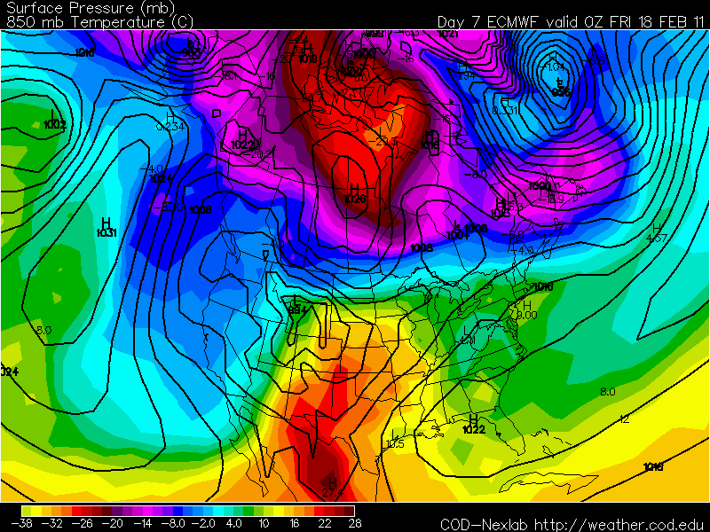
We will continue to see lasting precipitation throughout the afternoon as the surface low continues to move northeast. Acculumations of ice will still cover most of the MS region especially if the wet-bulb temperatures continue to stay below freezing. Now as temperatures warms up, we will mostly just have rain. It's hard to believe that our normal highs around this time of year are in upper 50s especially when when we have gone this entire week with highs struggling to get even into the 40s. After noon today we should start to see precipitation slack off a bit around the Jackson area as our surface low moves out. Lingering moisture will persist through the evening and we should be totally done with the rain by Saturday morning. After that a high pressure begins to move across the region with temperatures increasing just a bit on Saturday. Now by Saturday evening winds will shift from the northwest to the south. Although we won't hardly feel the effect of it Saturday night, Sunday we should experience this change with temperatures warming up to our normal around this time of year. It'll be great to have some warmer temperatures after having highs average around the mid 30s for this week. Models show precipitation entering back into the forecast Monday.

Weekend Forecast

Friday-
Today, we will still have persisting rain throughout the morning hours into the afternoon. As the afternoon progresses, rain should start to diminish some. You still will need to drive safely and cautiously throughout the day. Be careful driving over bridges and just really take your time wherever you go. Temperatures will be slightly warmer today reaching the upper 30s. The good thing is that we won't really have strong winds blowing today with winds from the northwest at 5mph. Gray and overcast conditions to consume the skies and this will last throughout overnight. By tonight, most of the rain will be out but there will be no escape from the cold temperatures as they drop back into the mid 20s. Northwest winds at 5mph.

Saturday-
A change in scenery as sunny conditions make its return. Temperatures will try to stay up for a bit warming up to the mid 40s. By the evening time, winds will shift from the north to the south. We will definitely feel the effect on Sunday but for Saturday night temperatures will once again plummet back into the 20s with mostly clear skies.

Sunday-
For Super Bowl Sunday, a little relief from the cold temperatures as highs rises to the mid 50s. A very brief break from the cold Arctic air we have gotten used to. A mostly clear day with south winds at 5 to 10 mph. Look for lows around the upper 20s.

Long-term
We could see our next chance of rain come next Monday, but I don't think we will see much from it as models depicts the cold front moving swiftly through. However, this cold front will once again filter cold air back into the southern region. Wednesday, we could have a chance for snow but it is hard to have an accurate assessment in determining it due to model disagreement with the timing of it. There do seem to be much agreement with even colder temperatures Thursday and Friday. Next Friday morning, we could wake up with temperatures or 10 DEGREES or BELOW! You definitely do not want to miss next week's weather blogs.

Again, drive safely today and be careful with your travels. Enjoy the Super Bowl on Sunday. I will be going for the Packers, so go Packs! I hope its a great game as I'm sure it will be. Thanks for viewing your Face of the Sky daily and weekend forecast. Hope you all have a great weekend and God bless!

music


Get a playlist! Standalone player Get Ringtones